
The Project Proposal
By 1970, the archaeological world had determined to adopt a programme of education and research to inform the interpretation of prehistory and history. In January 1970, a proposal to establish a working "ancient farm" was produced. The following summary, taken from the original, clearly provides the relevant background.
SUMMARY
The proposal to set up a permanent working ancient farm on Little Butser is being made by the Research Committee on Ancient Agriculture of the British Association for the Advancement of Science and the Council for British Archaeology. The paper that follows sets out in some detail the reasons for the project and how its development is envisaged. In short, it involves the establishment of an institute unique in this country which should bring great benefit in archaeological interpretation, in the presentation of prehistory and history to students of all ages, in the use of educational methods involving practical work and in interesting the public who visit Butser. The need for it in terms of research has been demonstrated abundantly by hundreds of inadequate single experiments. Investigation of farming practices requires appropriate and very varied skills as well as years of scientific recording. The final justification for the permanence of the ancient farm will be that it lies at the core of a research institution whose teaching virtues stretch beyond pure archaeology into natural history, ecology and the inculcation of simple accurate observation, vital to research in all fields.
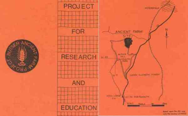
The cover below, shows the general style, the logo and the location of the proposed site on Butser Hill, Hampshire UK. A point of interest is that the logo, appearing for the first time, was designed by David Johnston, lecturer at Southampton University and member of the Research Committee on Ancient Agriculture.
For the full Proposal click here
It was as a direct result of this proposal being adopted by the CBA, that Peter Reynolds was identified as a candidate to run the project because of his emerging work and publications in the field of experimental archaeology, while still teaching classics at Prince Henry's Grammar School, Evesham.
However, little could be done until funding had been established. Finally the Woolfson Foundation came up with an offer of £30,000, a substantial sum in the early 1970's. This was regarded as sufficient to fund the first three years of the Project and Peter Reynolds accepted the offer to take on the exercise. Years later, when struggling as an independent, he remarked that, "His salary at that time was an advance on that as a history teacher ... whatever happened in-
One feature of the Project management by the CBA was the succession of title changes to the Managing Committee, from Steering Committee through to the setting up of a Charitable Project Trust. Peter's annual reports, "budget projections" and progress included, are also at the Hampshire Record Office.
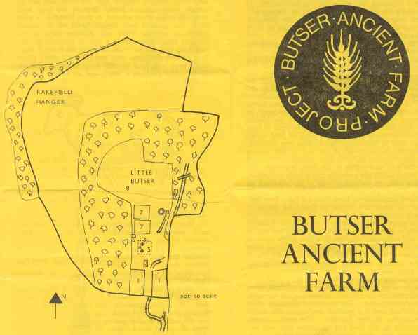
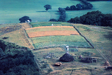
Once up and running, the site progressively evolved, with both house construction and cereal growing becoming routine. By 1974, after two years, the site was opened to the public for a couple of days in August. It would not have looked as complete as in the view below but it was on its way. The diagram above was prepared for this Open Day. The areas faintly marked 1 are the animal compounds. Area 5 is where the houses were and Area 7 represents the cereal fields, all more clearly seen in the view below.
This is one of many overviews of the site at Little Butser and shows the barrel shaped profile of this inhospitable spur. The small white erections spaced across the cereal fields, with one at each end and one centrally, are all believed to be weather recording stations, presumably because it was not known at this stage whether one or other location was best representative.
Several roundhouses can be seen at various stages of development, as Peter was starting to explore the effect of size on the constructs' design. At this early stage the public did not have routine access to the site, except for the Open Days alluded to above. The animal fields were located beneath the point from which this view is taken.
Butser Hill Field Systems
The location of the Ancient Farm on Hampshire County Council land in what is now the Queen Elizabeth Country Park was not just a happy accident. The County Archaeologist of the day was a member of the founding Committee. It was well known that the location had evidence of Iron Age Field Systems.
The two slides given here were taken just when they were most dramatically brought out by a snow fall. They show just how fully the slopes of Butser Hill were farmed .... intensively might well be a fair description. This was part of the reasoning used by Reynolds to argue that this region was highly populous. The final point was that the original Research Site on Little Butser showed evidence of use, even though on an inhospitable north-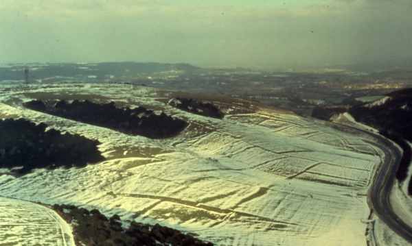
The above picture shows some of the slopes of Butser Hill to the west of the A3 to London, which is on the far right. These slopes are roughly northwards of the BAFDA site, the public demonstration area set up when the Queen Elizabeth Country Park was opened. The Little Butser Research Site was over the top of the hill, just left of centre. The entire boundary system comprises Celtic Fields. With no snow covering the boundaries are only apparent in low angle light.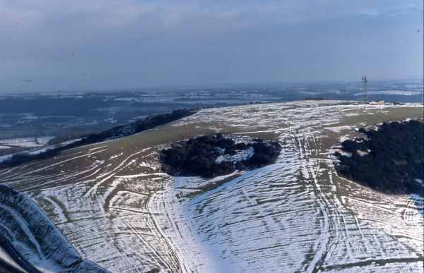
This view of the top of Butser Hill illustrates further Celtic Field boundaries can be located from the relationship with the modern road cutting to the bottom left. This cutting is beyond the view above and on the Petersfield side of the Hill, looking back towards the direction of BAFDA. Little Butser is off to the right, almost behind the viewer.
The whole area around and including Butser Hill was extensively surveyed by Stuart Piggott, [Investigator, Royal Commission on Ancient Monuments in Wales and Monmouthshire] and published in Antiquity 1930 pp 187-
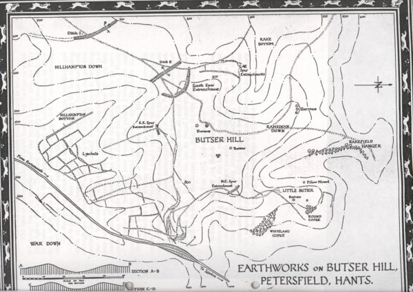
This is a copy of a copy etc. and the "originating" copy for this scan is skewed. Little Butser is shown centre far right. The radio mast in the modern photographs is roughly centre stage below the title Butser Hill, as best judged without a site survey. The BAFDA site is just off the bottom left this drawing. The ditch and bank is the short vestige immediately left of the title Butser Hill. The lynchet system would have been photographed on an alignment roughly parallel to the road shown. The line of the modern dual carriageway was not drastically altered from that shown. The direction of London is shown below the road, centrally, to the right of the cutting.