


The Wroughton Site
Wroughton, in north Wiltshire, is the location of a Science Museum storage facility, using the abandoned hangers of the old airfield. The offer was made to allow the setting up of one of the new generation of earthworks designed and developed by Peter Reynolds, based on lessons from the two sites at Butser proper. The octagonal design, is shown dramatically in the view below, before any revegetation had started, and taken on its completion in 1985. This was the only activity at this location.
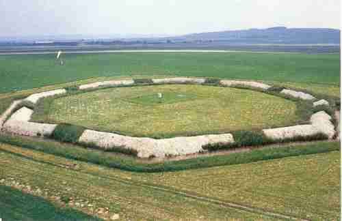
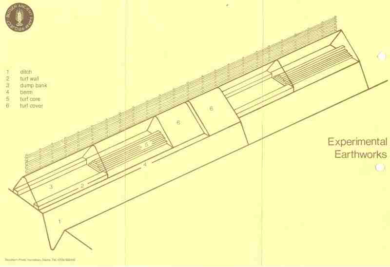
This view is far and away the best photograph from which to appreciate the design details of the "Reynolds" octagonal earthworks, as given in the diagrams below. Clearly seen are the following features : the central turf covered section of the bank : those lengths of each berm (ledge) at the inner top lip of the ditch, below the bank, and which are variously "berm-
It should be re-
This diagram delineates the "variables" of construction that were thought, at the time of the design, to be most likely to influence the way in which ditch and bank systems might change with time. Thus it was expected that the likely archaeological "imprint" of the different elements along the arms would aid in the interpretation of future and existing excavation evidence. It had already been discovered from the BAFDA earthworks that, contrary to the expectation of many, the inner face of a ditch, with a bank above, eroded less than the opposite outer face. This led to the choice of some of the features adopted.
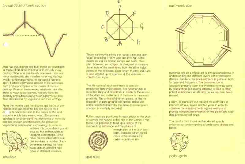
This part of the leaflet, from which the above diagram was taken, gives additional background to the approach adopted. Download the leaflet here.
By way of an historical curiosity, a Research Paper of the Society of Antiquaries of London, from 1946, was found in 2008 in Peter Reynolds files. This indicates he had looked at past work.